Maps from Class Workshops
I created these maps for two structured workshop assignments in my Advanced Geographic Information Systems course. Feel free to comment or email me if you have any questions about the map contents.
Thanks for taking an interest in my work! All maps and illustrations on this website are my own, unless specified otherwise.
I created these maps for two structured workshop assignments in my Advanced Geographic Information Systems course. Feel free to comment or email me if you have any questions about the map contents.
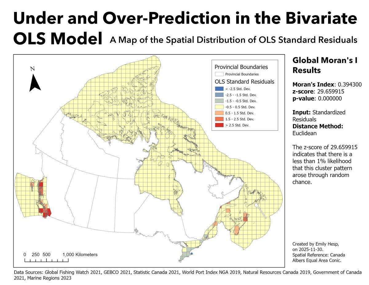
Below are a few maps I created for my recent GIS research project, where I applied statistical methods to explore the spatial relationships between vessel count density and densities of various other spatial features across Canada. This project was completed for my Advanced Geographic Information Systems course and was completed with open source data. At…
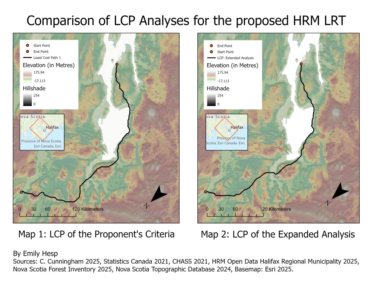
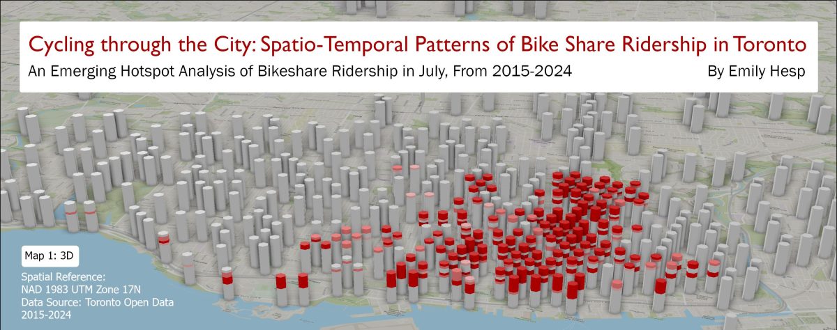
This project was completed for one of the two Independent Projects assigned in my Geographic Information and Mapping II course last year. These projects had us apply the theory and ArcGIS pro techniques we learned to analyze spatial data for a given scenario. For this particular project, students were expected to apply their knowledge of…
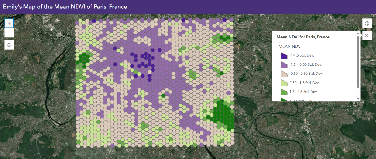
Web Map Link: Click Here! This project was created for the unit on Remote Sensing in my Geographic Information and Mapping II course last year. For this project, we were provided satellite images of different urban centers accross the globe and were expected to create I created an interactive web map of the distribution of…
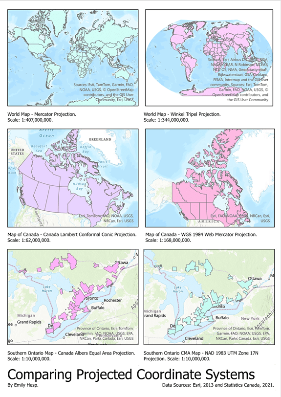
For this project, the following data was used to create six visualizations of six different map projections: Filename File type Description Data reference (source) worldcountriesWGS84 Shapefile Boundaries of countries mapped using the WGS84 coordinate reference system Esri, 2013 canada_prov_terrWGS84 Shapefile Boundaries of Canada provinces and territories mapped using the WGS84 coordinate reference system Esri, 2013…